
Bangalore Metro Route Map: Lines, Stations, Timings, Fare & Latest Updates
Bangalore Metro, also called Namma Metro, is one of the fastest and easiest ways to travel across Bengaluru. With growing traffic and long travel times, more people now search for the Bangalore Metro Route Map to plan daily commuting, office travel, and sightseeing trips. This guide covers everything you need-metro lines, interchange stations, timings, ticket prices, and tourist places connected by the metro.
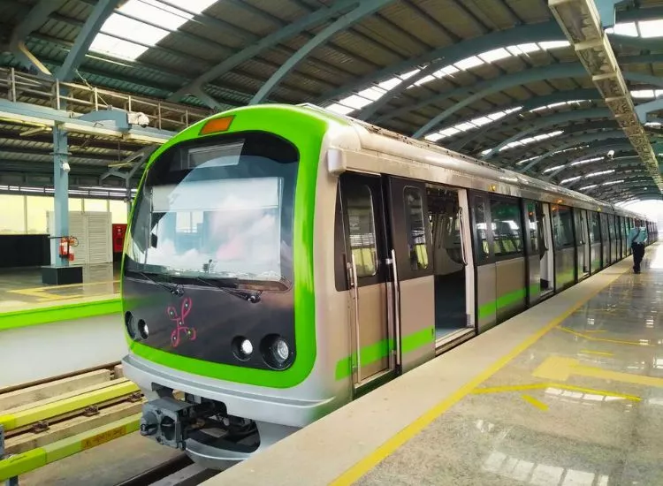
Overview of Bangalore Metro
The Bangalore Metro Rail system is managed by BMRCL (Bangalore Metro Rail Corporation Limited). It connects major areas like Majestic, MG Road, Whitefield, Mysuru Road, Yeshwanthpur, and Nagasandra.
Namma Metro is popular because it is:
- Fast
- Affordable
- Safe
- Clean
- Great for daily commuters
Bangalore Metro Route Map – Quick Information
Here is quick information about the Bangalore Metro Map:
- Metro Name: Namma Metro
- Operator: BMRCL
- Main Lines: Purple Line & Green Line
- Key Interchange: Nadaprabhu Kempegowda Station (Majestic)
- Payment Options: Tokens, Smart Card, UPI, QR Ticket
Also Read: Delhi Metro Pink Line
Bangalore Metro Lines Explained (Purple Line & Green Line)
1) Purple Line Metro (East-West Corridor)
The Purple Line is one of the busiest routes and connects important areas like IT hubs, shopping streets, and central Bengaluru.
Popular stations include:
- Whitefield (Kadugodi)
- KR Puram
- Indiranagar
- MG Road
- Majestic
- Mysuru Road
Best for: Office travel, shopping, and city sightseeing.
2) Green Line Metro (North-South Corridor)
The Green Line connects North Bengaluru and South Bengaluru, covering major residential and market areas.
Popular stations include:
- Nagasandra
- Yeshwanthpur
- Mantri Square Sampige Road
- Majestic
- Lalbagh
- Yelachenahalli
Best for: Daily commuting and connecting bus/rail routes.
Important Interchange Stations in Bangalore Metro
Interchange stations help passengers switch lines easily.
Top interchange stations:
- Majestic (Nadaprabhu Kempegowda Station) – Purple ↔ Green
- KR Puram (Upcoming/Expansion Connectivity) – future major interchange
- Jayadeva Hospital (Upcoming) – future connectivity boost
Majestic is the main interchange station and the most searched metro stop in Bengaluru.
Bangalore Metro Timings (First Train & Last Train)
Many people search daily for Bangalore Metro timings.
Metro timing usually starts early morning and runs till night.
General timings:
- First train: Around 5:00 AM – 6:00 AM
- Last train: Around 10:30 PM – 11:30 PM
⏱️ Timing may change during:
- Weekends
- Festivals
- Maintenance days
Bangalore Metro Fare Structure (Ticket Price & Smart Card)
The Bangalore Metro fare depends on distance and number of stations.
Ticket options include:
- Token Ticket (single journey)
- Namma Metro Smart Card (best for daily travel)
- QR Tickets (mobile booking)
Smart cards are popular because they offer:
- Faster entry
- Recharge options
- Discounts on fares
How to Read the Bangalore Metro Route Map
If you are using the metro for the first time, reading the Bangalore Metro Route Map is very easy.
Simple way to understand:
- Find your starting station
- Find your destination station
- Check if your route needs an interchange (usually at Majestic)
- Count the number of stations
- Check the direction (terminal station name)
Follow the correct line color:
- Purple = East-West
- Green = North-South
Major Tourist Places Connected by Bangalore Metro
Tourists often search for places connected through the Namma Metro route map.
Here are top tourist attractions near metro stations:
- MG Road Metro Station – Shopping streets, pubs, city vibes
- Cubbon Park Metro Station – Cubbon Park, Museum, Vidhana Soudha
- Lalbagh Metro Station – Lalbagh Botanical Garden
- Vijayanagar Metro Station – Markets and local Bengaluru culture
- Indiranagar Metro Station – Cafes, nightlife, and food streets
- Majestic Metro Station – City center, bus station, railway station
Benefits of Using Bangalore Metro
The Bangalore Metro is becoming the #1 travel choice because it helps people avoid traffic and saves time.
Key benefits:
- Saves travel time
- Reduces fuel cost
- Eco-friendly public transport
- Safe for women and families
- Less stress compared to road traffic
- Easy access to major hubs
Tips for First-Time Metro Travelers in Bengaluru
If you are new to Namma Metro, follow these simple tips:
- Buy a Smart Card if you travel regularly
- Always check the last train timing
- Stand in the correct queue for tokens
- Keep your bag ready for security check
- Follow metro rules and stay behind the yellow line
- Use metro maps inside stations for quick direction
Future Expansion of Bangalore Metro (Upcoming Lines & Extensions)
Bangalore Metro is expanding quickly, and many people search for the Bangalore Metro route map latest update.
Upcoming improvements include:
- New metro corridors
- Better airport connectivity (future plans)
- More interchange stations
- New routes connecting outer Bengaluru
This expansion will help metro reach more areas like IT parks, tech zones, and new residential locations.
Conclusion
The Bangalore Metro Route Map (Namma Metro Map) is the easiest way to understand Bengaluru’s metro connectivity. Whether you are a daily commuter, student, office worker, or tourist, Namma Metro helps you travel faster, cheaper, and safer. With new expansions coming soon, Bangalore Metro will become even more important for the city’s future.
Frequently Asked Questions (FAQs)
What Is The Bangalore Metro Route Map?
The Bangalore Metro Route Map shows all metro lines, stations, and directions. It helps people know where the metro goes and which station they should choose.
How Many Metro Lines Run In Bangalore Metro?
Bangalore Metro runs on two main lines right now. These lines are called the Purple Line and the Green Line. New lines will start soon.
Which Areas Does The Purple Line Cover?
The Purple Line connects Whitefield to Challaghatta. It passes through busy places like MG Road, Majestic, and Indiranagar.
Which Areas Does The Green Line Cover?
The Green Line connects Nagasandra to Silk Institute. It passes through important places like Majestic and Jayanagar.
Where Do The Purple Line And Green Line Meet?
Both lines meet at Majestic Station. People change trains here to go to different routes.
How Can I Read The Bangalore Metro Route Map Easily?
You can read the map by checking line colors, station names, and direction arrows. Each line has a different color to make it easy.
Can I Download The Bangalore Metro Route Map Online?
Yes, you can download the Bangalore Metro Route Map from the official metro website or mobile apps.
Does The Bangalore Metro Route Map Show Interchange Stations?
Yes, the map clearly shows interchange stations like Majestic where you can switch lines.
Why Should I Check The Bangalore Metro Route Map Before Travel?
You should check the map before travel so you can plan your route, save time, and avoid confusion.
Is The Bangalore Metro Route Map Helpful For Tourists?
Yes, tourists use the Bangalore Metro Route Map to visit popular places in the city easily and safely.